Author: Jane
Date: 30 September 2011
Temperature: -26°C
Wind Speed: 12 knots
Temp with wind chill: -40°C
This has been an unusual year for the sea ice around Scott Base. In March it broke out in front of the base for the first time since 1997. The sea ice began to form again soon after the ice floes were washed out of McMurdo Sound. It is now around 1.8m thick in front of the base.
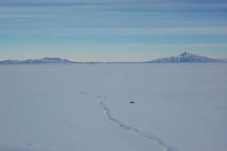
The ‘Big John’ crack extending out from Hut Point into McMurdo sound. This crack is now impassable. Mount Discovery to the right and Black Island to the left, with a mirage visible along the bottom. Photo AHT/ Jane
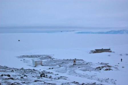
Further North the sea ice is still moving, causing the formation of large cracks. We managed to get to Cape Evans to do our Winter Hut Inspection on September 17th, but we had to park the Hagglund a few hundred metres out from the shore due to cracks in the sea ice which were not safe to cross in a vehicle. A few days later it was impossible to get to this area, as cracks along the flagged route had opened up substantially. One of the cracks we crossed is now about 2.5m wide.
Looking down on Terra Nova hut from Windvane Hill with the Barne Glacier in the background and the Hagglund parked out on the Sea Ice.
Photo AHT/ Jane
The edge of the sea ice is now close to Cape Royds which is much further South than it has been in recent years. It has been very warm this winter, with temperatures often in the range of -10°C to -20°C. This combined with the frequent stormy conditions has hindered the sea ice formation. The cut-off date for sea ice growth is usually mid-October so it is unlikely to improve enough to allow for vehicle travel in the area over the summer season. This will have an impact on our work.
To see out what our weather looks like on Ross Island you can check out the webcams at Scott Base, Arrival Heights and the windfarm by clicking on this link: http://www.antarcticanz.govt.nz/scott-base/webcams


