By Willem Renema, NCB Naturalis & Ken Johnson, NHM London
Hi, we are Willem Renema of NCB Naturalis and Ken Johnson of NHM and we are searching for new outcrops. An outcrop is a site where rocks are sticking out of the ground and available for study. To collect new data the project must find new outcrops, and that is our job for the week. We are currently 70 km north of the other two Throughflow groups in the town of Bengalon.
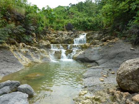
How does one find these outcrops? Unfortunately due to heavy tropical rains and intense weathering rock outcrops do not last very long in the tropics. East Kalimantan is a large area, and besides being rare, useful outcrops must show the right kind of rocks for our study, so it is almost like searching for a needle in a haystack. Luckily we have data from researchers who studied this are more than 80 years ago. Today we were looking for outcrops first discovered by LMR Rutten who spent from 1911 to 1913 looking for mineral resources such as coal, oil and minerals. Rutten collected very fossiliferous rocks from outcrops "2.5 km NW of Kaliorang" and we have seen these exceptional fossils in the collections of NCB Naturalis. Using this information and modern GIS technology we were able to locate a nice outcrop with similar kind of fossils that must be very near to the rocks that Rutten described. The site is in a small river valley with a series of small waterfalls cascading over limestone beds. Luckily, erosion by the river keeps the rocks clean and accessible. The rocks contain exceptionally preserved fossils, including all target groups for the Throughflow project. After working so hard to relocate the site, we are very pleased with ourselves to actually find the fossils in their context.
Beautiful fossils at a lovely site on the Sungai Kapia near its confluence with Sungai Narut
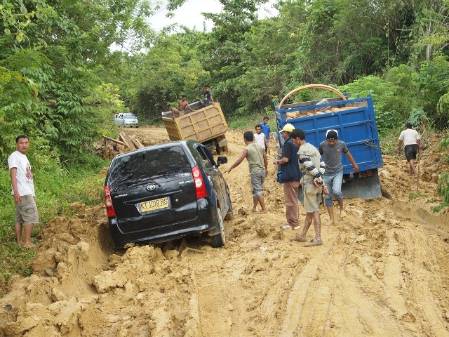
Energized by our morning success and our delicious nasi campur lunch we decided to look for Leupold's locality near Sangkuliran. Leupold was a swiss explorer hired by the Dutch government in the 1920s to report on mineral resources in the area. His notes and samples are also held in the collections of NCB Naturalis. This particular locality is described as being ‘at the northernmost tip of the island on which the village of Sangkuliran lies‘ . We had only ten km to drive from our lunch spot, and were confident to be successful here as well. Unfortunately, due to heavy tropical rain and intensive use, roads don’t last very long in the tropics. After a short 3 km ride, we were stopped by a queue of 5 lorries behind 3 other lorries and a passenger car stuck up to their axles in deep mud that had once been the road. One hundred years ago our predecessors would not have been fazed as their mules could easily cope with a bit of muck. Sadly, we were forced to retreat southward but we took the opportunity to stop again at the site of the beautiful river valley with lovely fossils. As the sunset lit up the clouds in the western sky, we returned to Bengalon to prepare for our next day of hunting for treasures in East Kalimantan.
End of the road at the mud trap 7 km from Sankulirang


