

William Smith (1769-1839), a National Treasure!
Our Library blog will give us the opportunity to highlight some of the gems in our collections, particularly those which are large or delicate and therefore difficult for us to bring out for visitors to the Library.
One of the largest items in our collections is the William Smith geological map.

First published in 1815 under the title: A delineation of the strata of England and Wales with part of Scotland: exhibiting the collieries and mines, the marshes and fen lands originally overflowed by the sea, and the varieties of soil according to the variations in the substrata, illustrated by the most descriptive names.
Smith revolutionised the study of geological time as the first person to use fossils as a tool for determining the strata of rocks, rather than their composition. As a result he earned the nickname William 'Strata' Smith and the 'Father of English Geology'. His work as a land, mine and canal surveyor enabled him to see below the surface and study to structure of the ground.
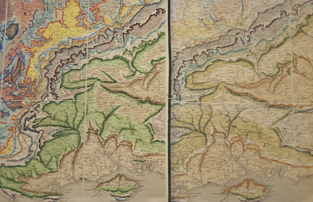
The map was produced in a number of formats: in sheets, mounted on canvas and rollers or spring rollers (with or without varnish), or on canvas in a travelling case. Our edition of the latter has kept the best, due to light and dirt being kept away. Many of those who bought the full sized copy and mounted it onto the wall, over time the colour faded, making the geological map pretty useless! The image below shows a section of our best copy put alongside the same section of our faded edition. This section includes the Bristol area which Smith knew very well.
Smith oversaw the hand colouring of each of the maps, signing and numbering each one (see image below). It is believed that around 400 may have been produced and that only 100 may still exist. The map was the first of its kind for this country and a ground breaker internationally. Today’s modern geological maps still owe a lot to William Smith.

Due to its size and fragility we only get Smith’s map out in all it's glory a few times a year, but keep your eyes on the Nature Live events page, the Library regularly teams up with the Palaeontology Department to do a William Smith talk. This also includes a chance to see some of the specimens collected by William Smith himself.
Winchester, Simon (2001) The map that changed the world: the tale of William Smith and the birth of a science. London : Viking.
Morton, John L (2004) Strata: the remarkable life story of William Smith, the father of English geology. Horsham : Brocken Spectre.
There are more images of the map available via the Picture Library.
Further suggested reading: